


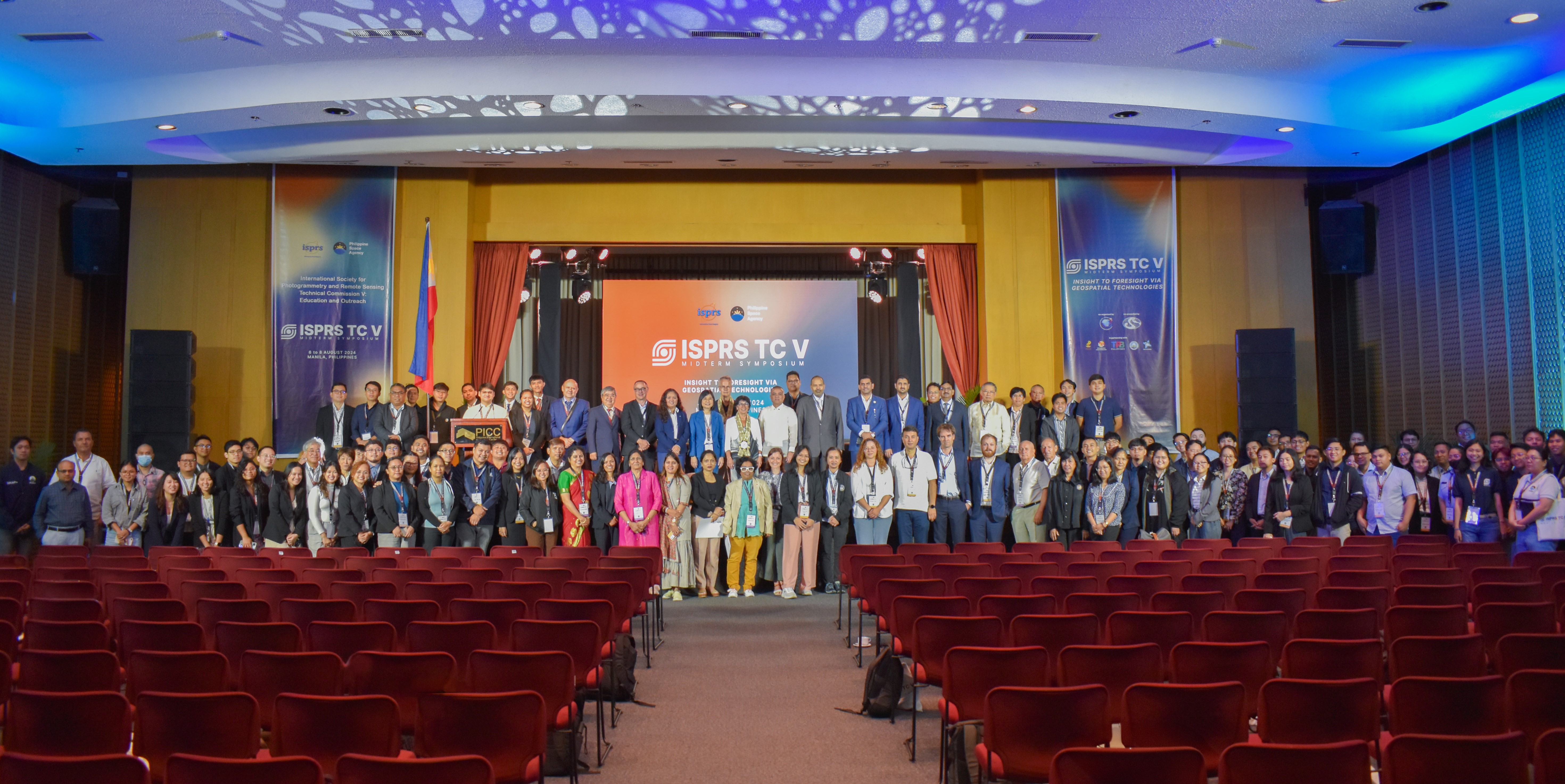
The Philippine Space Agency (PhilSA), in collaboration with the International Society for Photogrammetry and Remote Sensing (ISPRS), hosted the ISPRS Technical Commission V (TC V) on Education and Outreach Midterm Symposium from 6 to 8 August 2024 in the Philippines for the first time.
With the theme “Insight to Foresight via Geospatial Technologies,” the midterm symposium held at the Philippine International Convention Center (PICC) in Pasay City brought together experts from local and international agencies, government bodies, and students to exchange information, knowledge, and best practices on geospatial technologies.
The ISPRS is a non-governmental organization devoted to developing international cooperation to advance photogrammetry and remote sensing and their applications. The organization’s scientific and technical work is accomplished by five (5) Technical Commissions (TC). This includes the TC V on Education and Outreach, where PhilSA Deputy Director General for Space Science and Technology Dr. Gay Jane Perez serves as the president.
During the midterm symposium, Dr. Perez emphasized how the activities within the symposium were curated to inspire new methods of teaching and learning, promote collaboration, and ensure the accessibility and usability of geospatial data for professional educators and students alike. “Aligned with the goals of ISPRS Technical Commission V, PhilSA seeks to ensure sustainability in our knowledge workforce by educating the youth and engaging the academe, government, and the private sector,” said Dr. Perez during her welcome remarks.
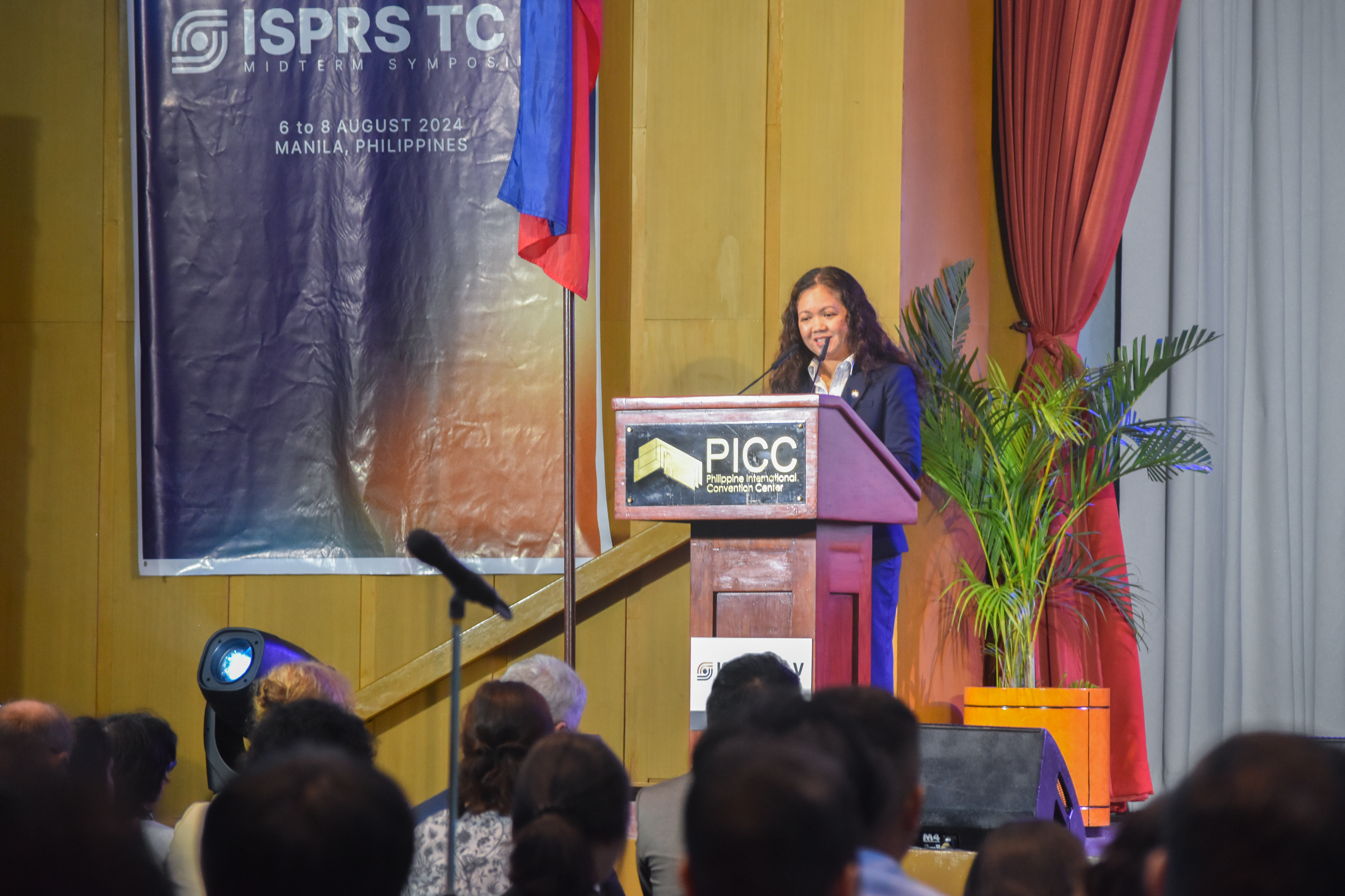 ISPRS TC V President and PhilSA Deputy Director General for Space Science and Technology Dr. Gay Jane Perez welcomes the participants to the symposium.
Three (3) plenary sessions, 14 parallel technical sessions, and a poster session, were held during the symposium. Topics highlighted the innovative geospatial technologies for training in applied and natural sciences, promoting education and training on disaster and risk management, education and outreach on spatial information science, development of regional and international training and education programs, open-source promotion and web-based resource sharing, strengthening awareness on Blue Economy and coastal marine environment, and education and training through curricula development and enhanced learning.
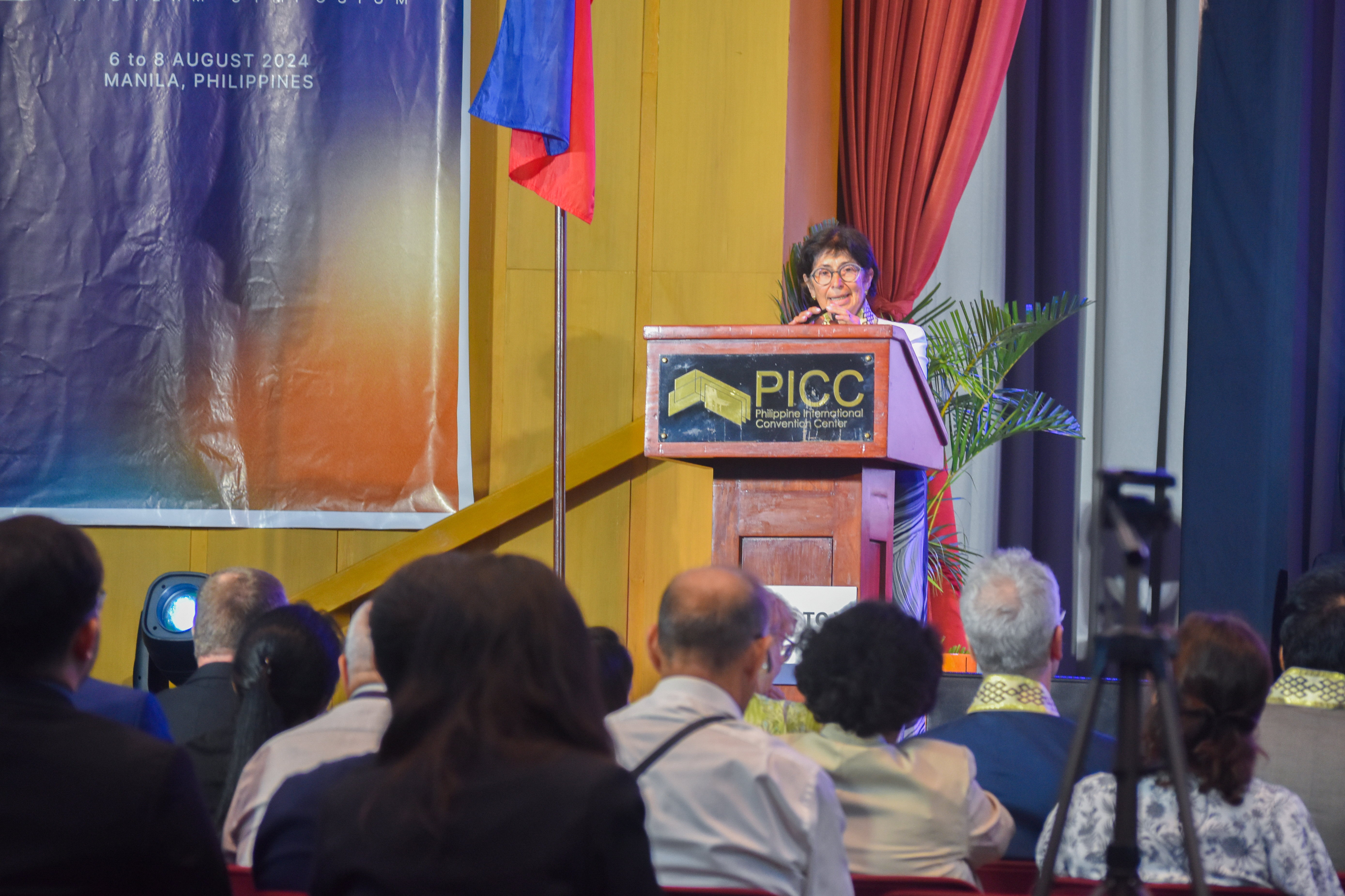
Dr. Lena Halounova, ISPRS President, recognized the participants’ commitment to a culture of learning through advancing knowledge in the field and capacitating fellow practitioners during the opening ceremony. “I am very glad you are involved in education, on behalf of the ISPRS, […] I believe you will not only accept the knowledge from my colleagues, but you will also spread your knowledge to other people, not only in the ISPRS, but also out of the ISPRS,” Dr. Halounova said.
 Special Message
ISPRS President Dr. Lena Halounova
Speakers from the European Space Agency (ESA), UP National Engineering Center, Geo-Informatics and Space Technology Development Agency (GISTDA), PhilSA, Centre for Remote Imaging, Sensing and Processing (CRISP) of National University of Singapore, SpaceCrop Technologies, North Eastern Space Applications Centre (NESAC), and UP Resilience Institute also introduced the programs and projects of their institutes and agencies for possible collaboration.
Day One
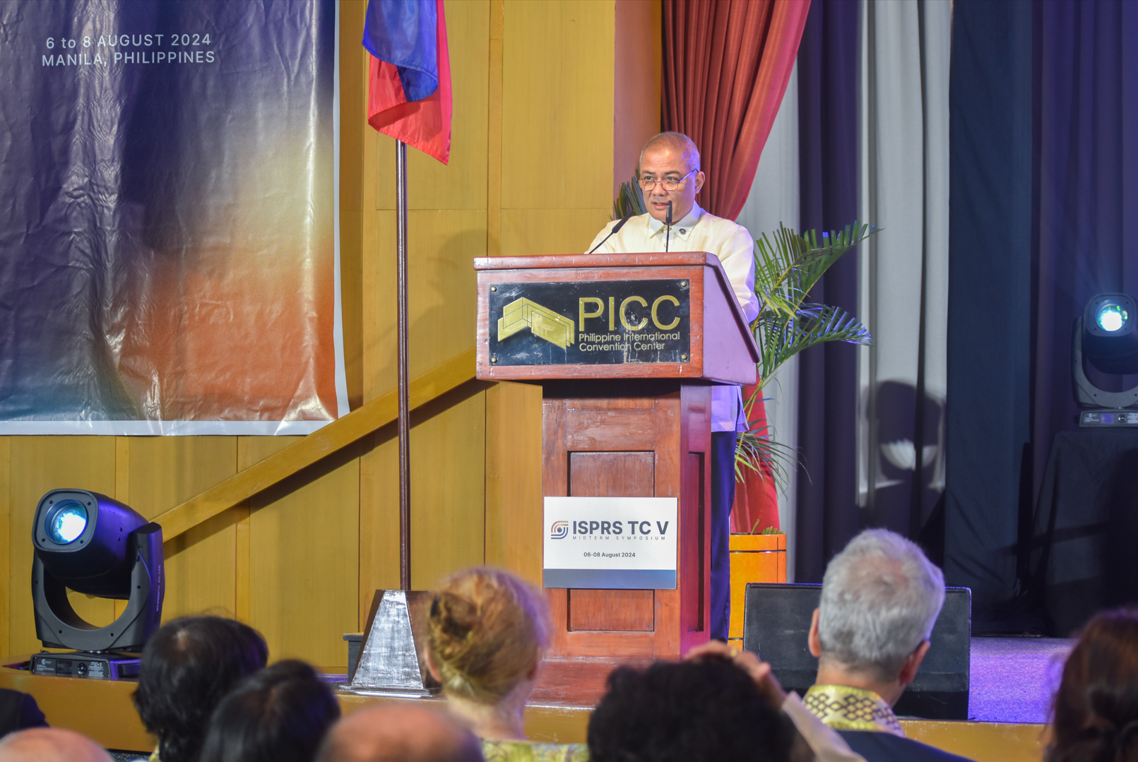
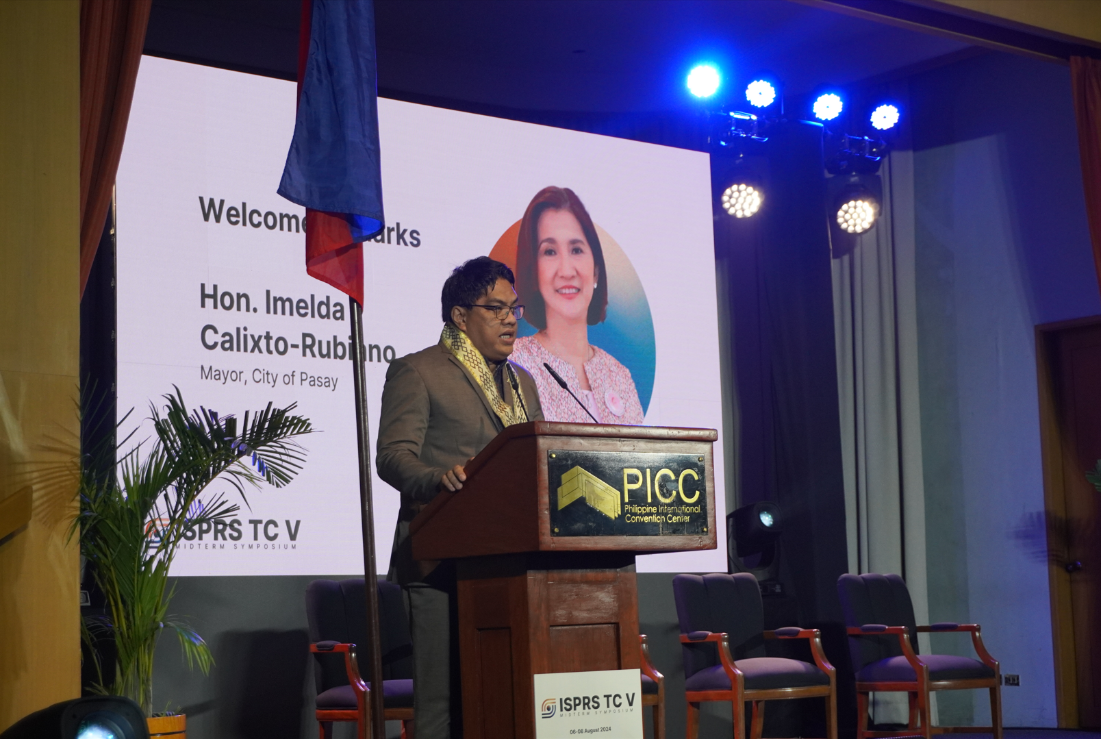 Welcome Address
On behalf of Pasay City Mayor Emi Calixto-Rubiano, Pasay City Chief of Staff Atty. Peter Eric Prado delivers the welcome remarks
 Special Message
PhilSA Director General Dr. Joel Joseph Marciano, Jr.
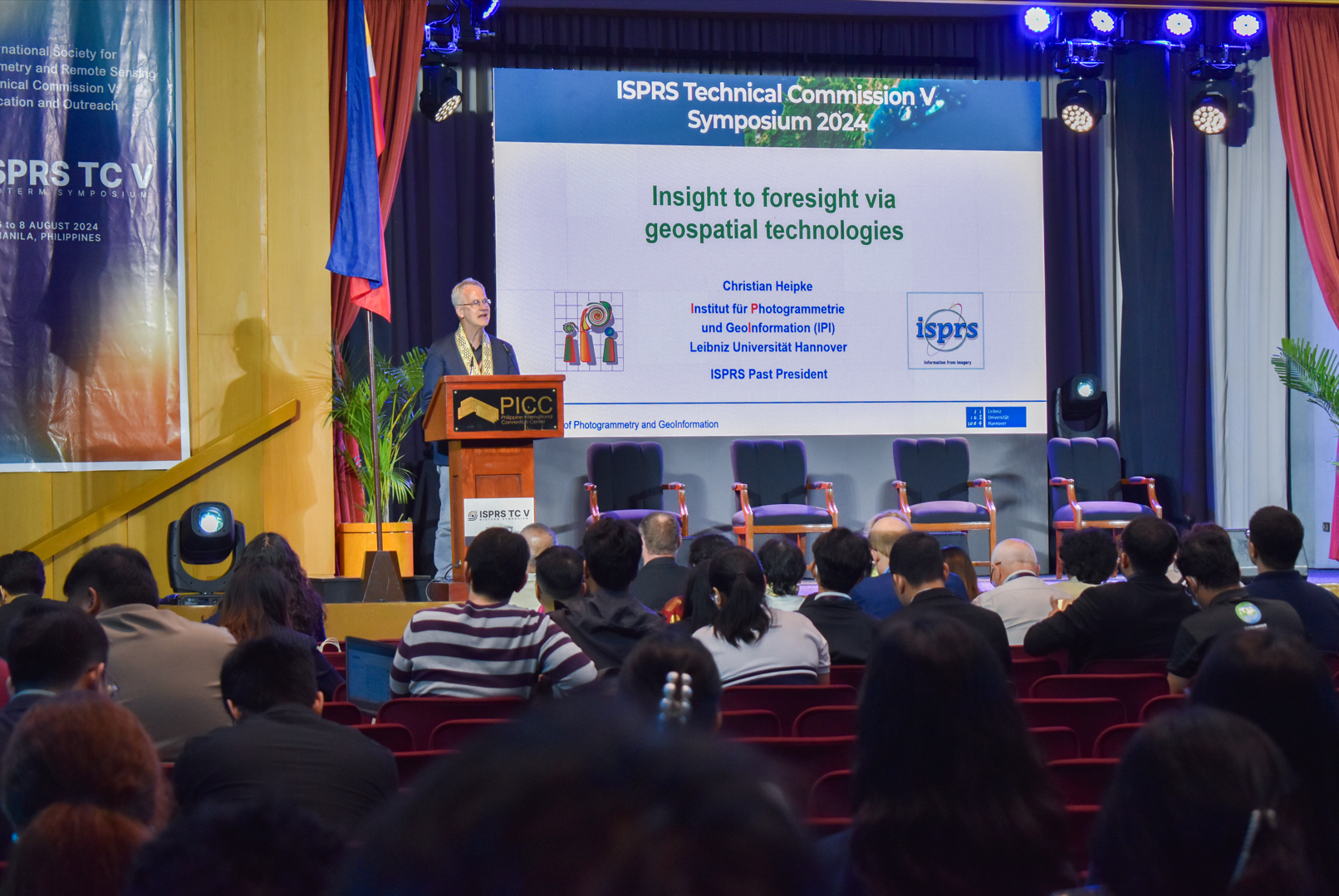 Keynote Message
Leibniz Universität Hannover Professor Dr.-Ing. Christian Heipke
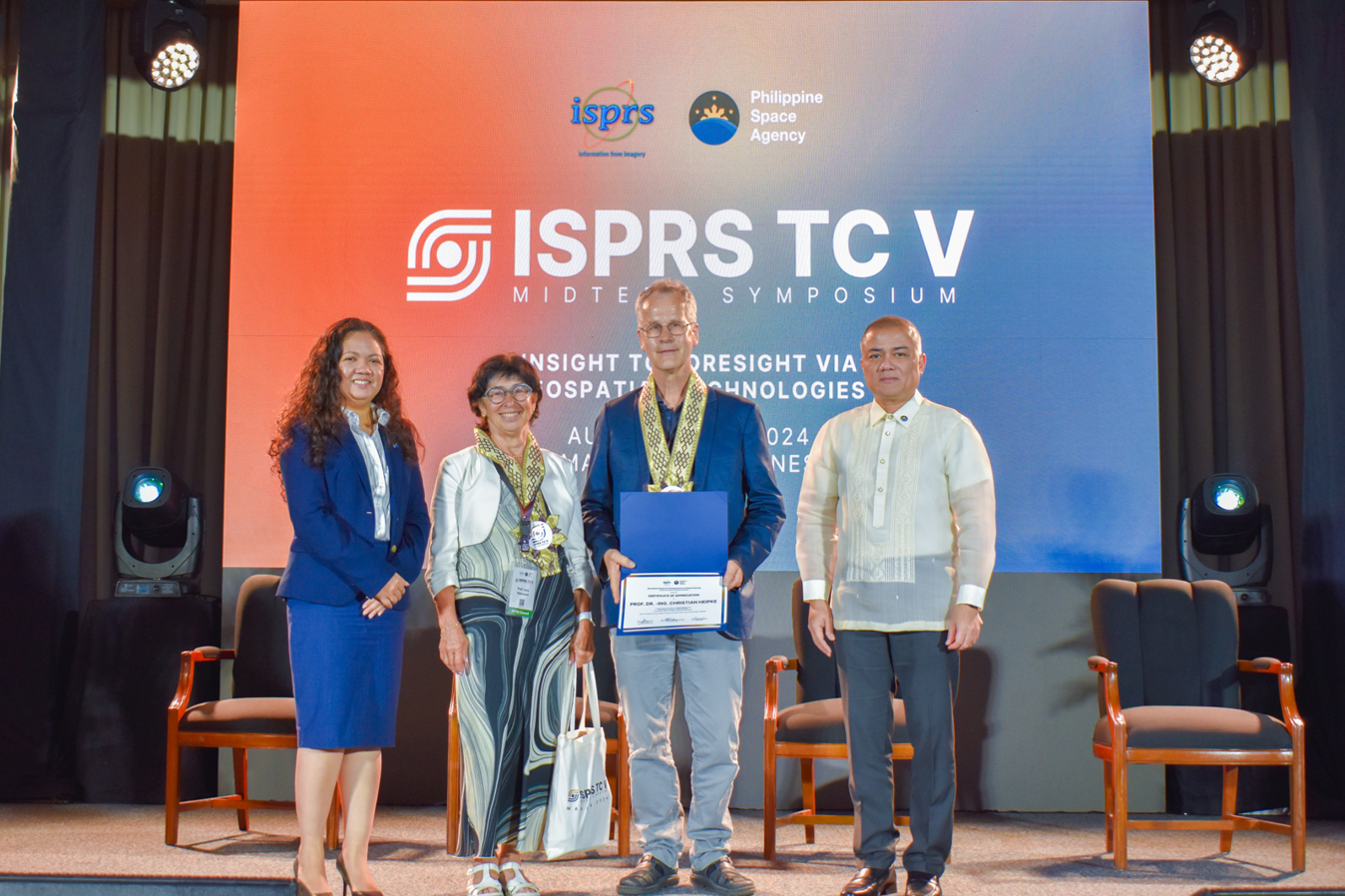 Certificate of Appreciation
Leibniz Universität Hannover Professor Dr.-Ing. Christian Heipke
Awarding of Travel Grants
 Jonali Goswami


Plenary Session 1
 European Space Agency (ESA) Directorate and Long-term Action Section in Earth Observation Head Dr. Benjamin Koetz


Parallel Sessions
 Day One Parallel Session: Innovative Geospatial Technologies for Training in Applied and Natural Sciences (WG V/6)

 Day One Parallel Session: Promoting Education and Training on Disaster and Risk Management (WG V/4)


 Day One Parallel Session: Education and Outreach on Spatial Information Science


 Day One Parallel Session: Innovative Geospatial Technologies for Training in Applied and Natural Sciences (WG V/6)


 Day One Parallel Session : Promoting Education and Training on Disaster and Risk Management (ICWG V/IV)


 Day One Parallel Session: Development of Regional and International Training and Education Programs


Fellowship Dinner
 UP Department of Geodetic Engineering Faculty Luis Carlos Mabaquiao


Day Two
Poster Presentation / Exhibit


Parallel Sessions
 White Elephant Session


 Day Two Parallel Session: Open-Source Promotion and Web-based Resource Sharing (WG V/3)


 Day Two Parallel Session: Innovative Geospatial Technologies for Training in Applied and Natural Sciences (WG V/6)

 Day Two Parallel Session: Strengthening Awareness on Blue Economy and Coastal Marine Environment (WG V/IV)


 Day Two Parallel Session: Academia-Industry Collaboration Session from ICWG V/IV


 Day Two Parallel Session: Open-Source Promotion and Web-based Resource Sharing


 Day Two Parallel Session: Strengthening Awareness on Blue Economy and Coastal Marine Environment (WG V/5)


 Day Two Parallel Session: Education and Training through Curricula Development and Enhanced Learning


Day Three
Plenary Session 2
 PhilSA Space Information and Infrastructure Bureau Director Dr. Ariel Blanco


Plenary Session 3
 North Eastern Space Applications Centre Dr. S.P. Aggarwal


Awarding of Best Paper & Presenter
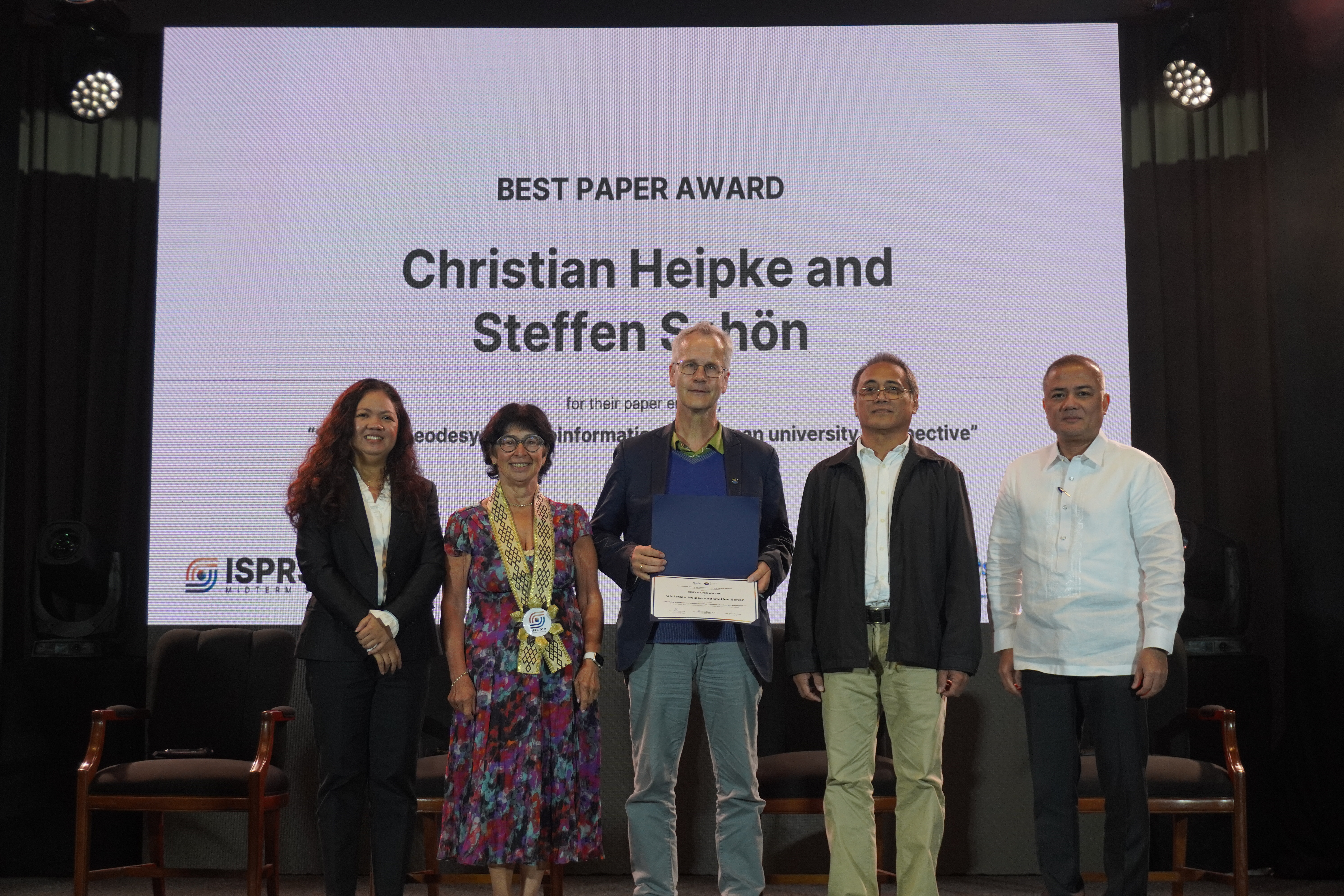 Best Paper Award: Christian Heipke and Steffen Schön for their paper entitled, “Studying Geodesy and Geoinformatics – a German university perspective.”
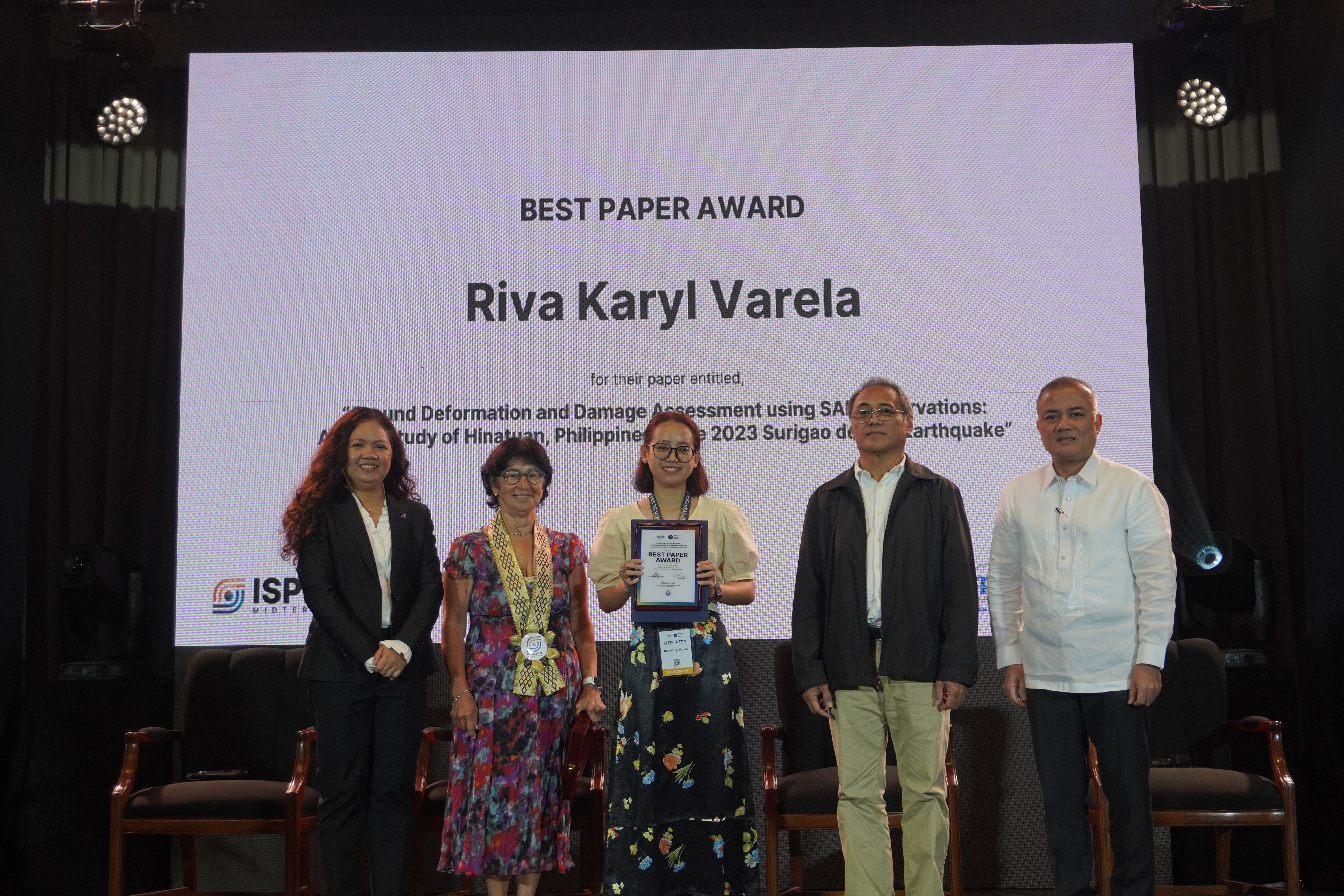
Best Paper Award: Riva Karyl Varela for her paper entitled, “Ground Deformation and Damage Assessment using SAR Observations: A Case Study of Hinatuan, Philippines in the 2023 Surigao del Sur Earthquake.”
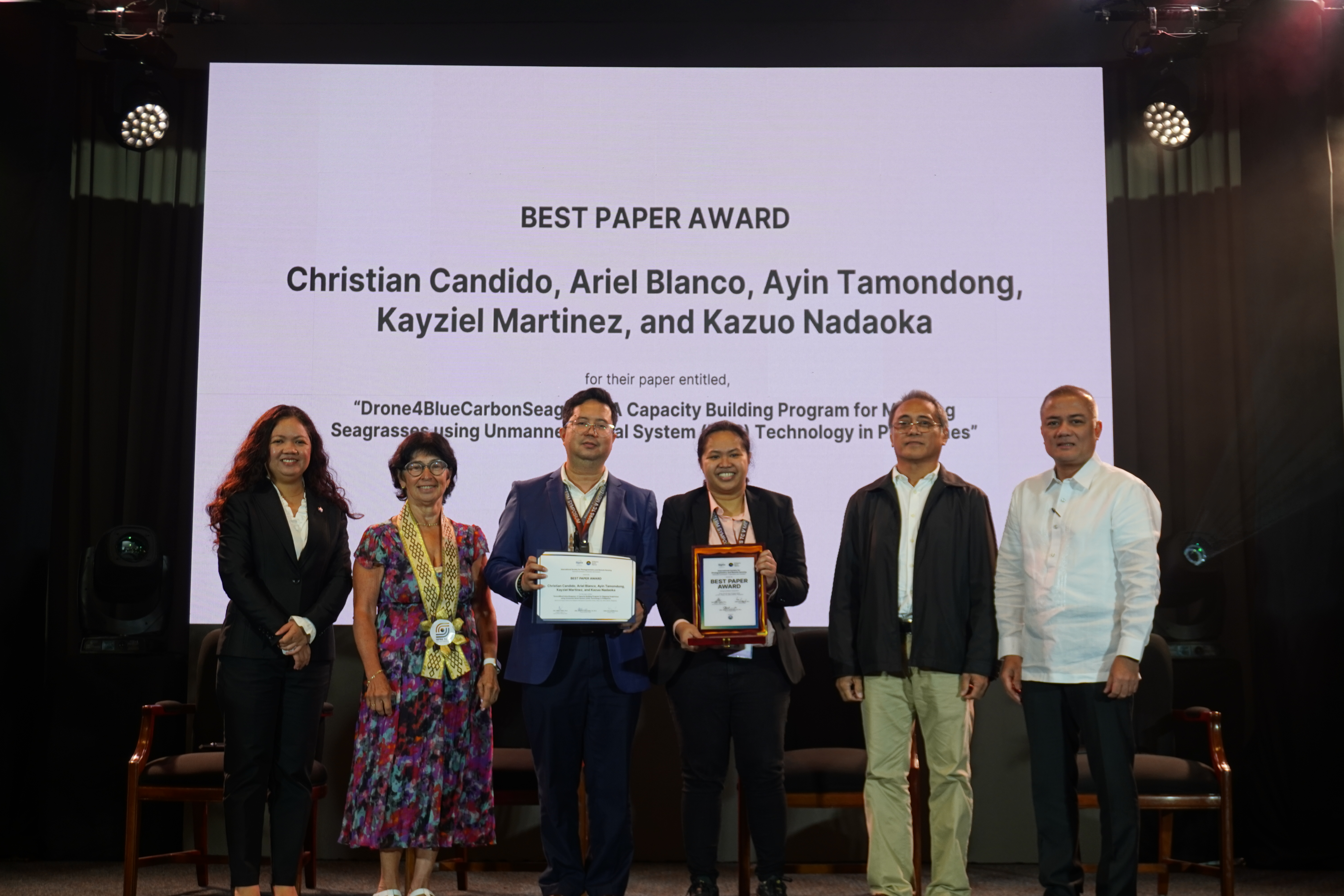
Best Paper Award: Christian Candido, Ariel Blanco, Ayin Tamondong, Kayziel Martinez, and Kazuo Nadaoka for their paper entitled, “Drone4BlueCarbonSeagrass: A Capacity Building Program for Mapping Seagrasses using Unmanned Aerial System (UAS) Technology in Philippines.”
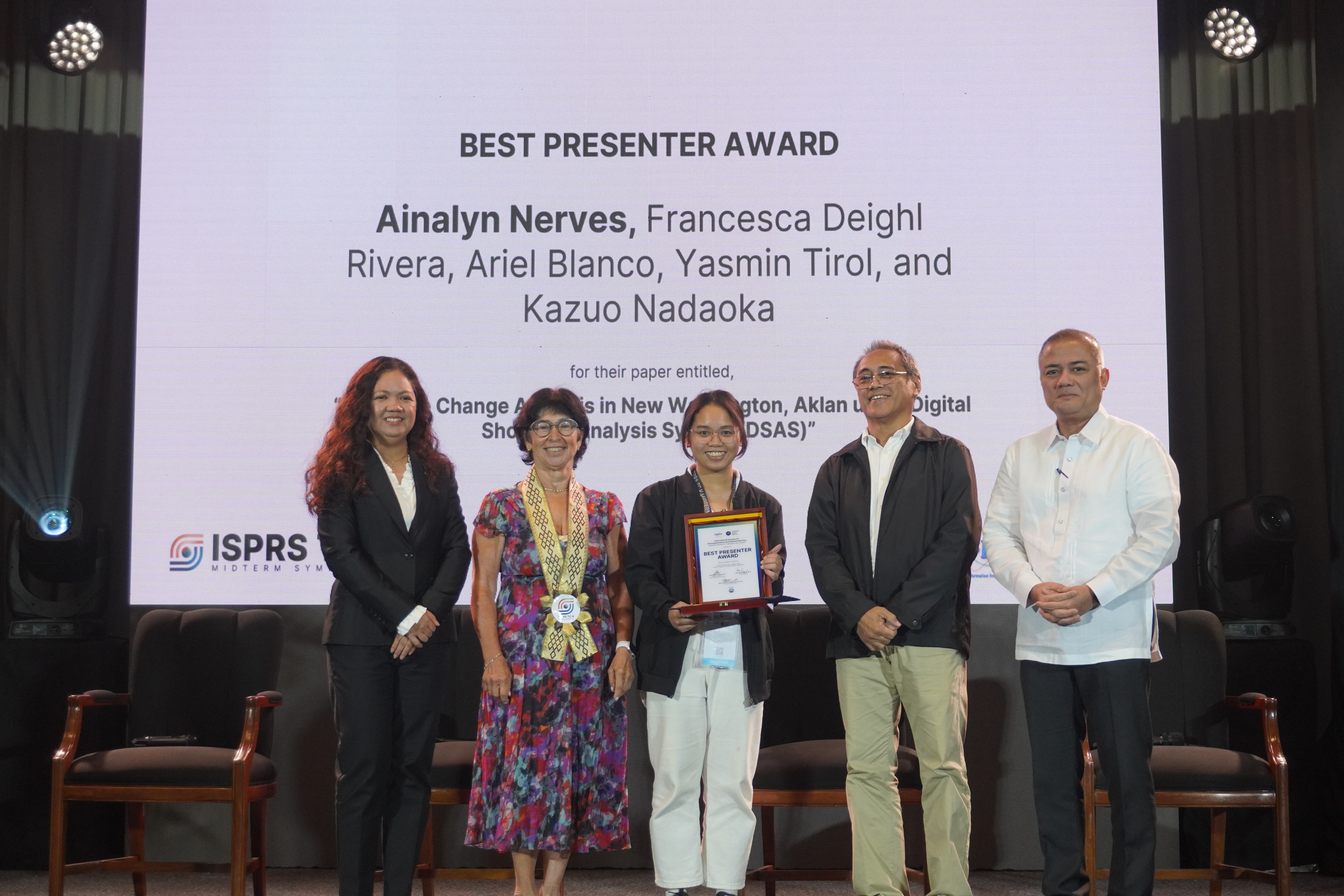
Best Presenter Award: Ainalyn Nerves, Francesca Deighl Rivera, Ariel Blanco, Yasmin Tirol, and Kazuo Nadaoka for their paper entitled, “Shoreline Change Analysis in New Washington, Aklan using Digital Shoreline Analysis System (DSAS).”
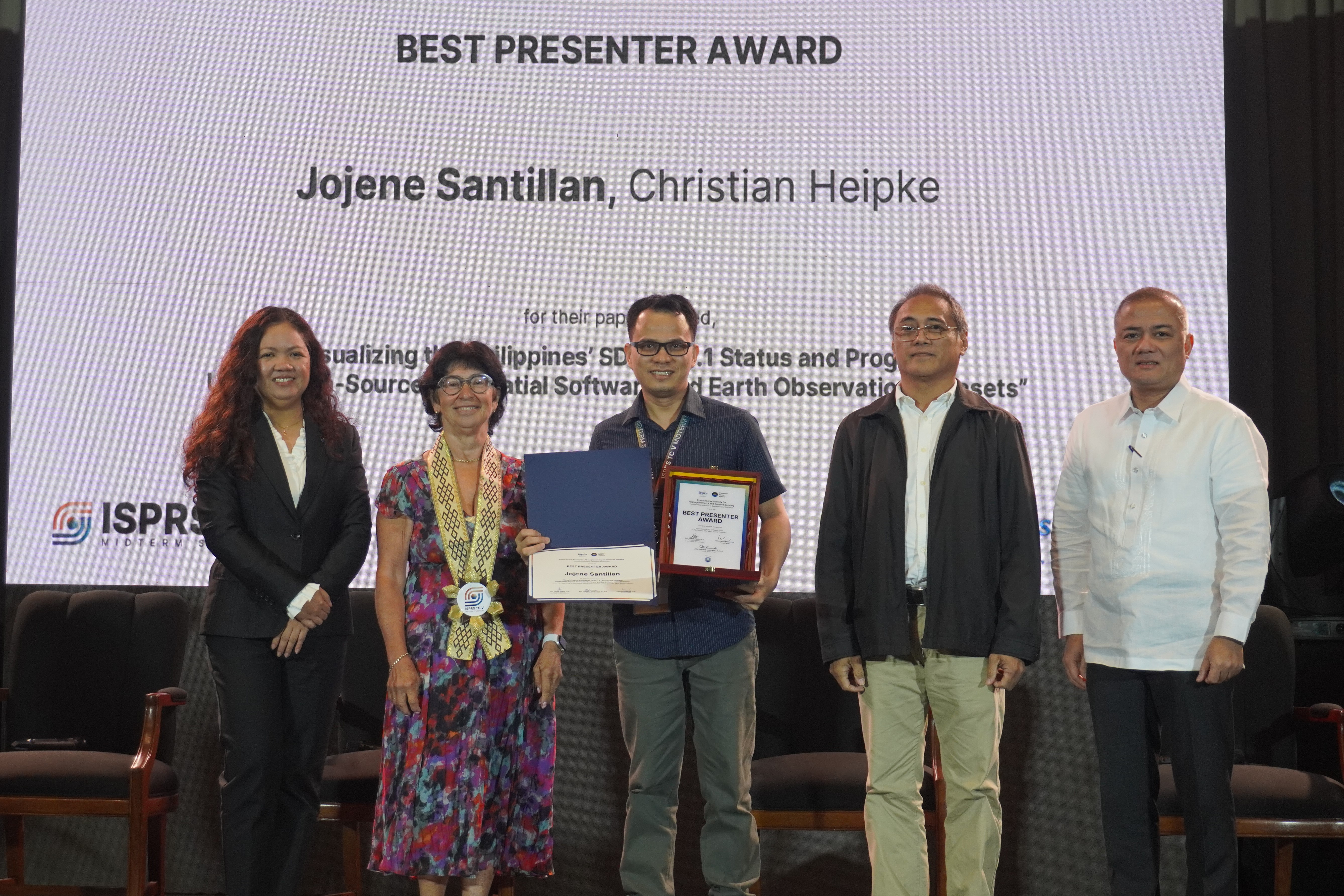
Best Presenter Award: Jojene Santillan and Christian Heipke for their paper entitled, “Visualizing the Philippines’ SDG 11.3.1 Status and Progress Using Open-Source Geospatial Software and Earth Observation Datasets.”
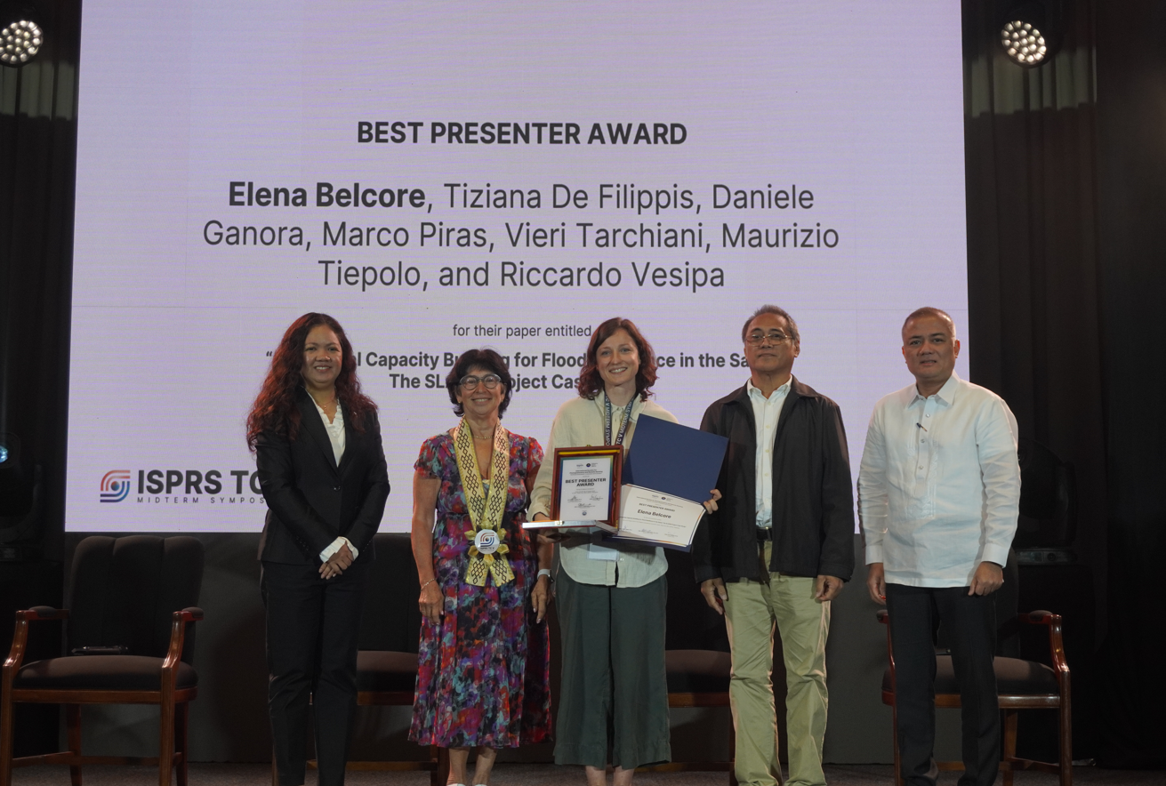 Best Presenter Award: Elena Belcore, Tiziana De Filippis, Daniele Ganora, Marco Piras, Vieri Tarchiani, Maurizio Tiepolo, and Riccardo Vesipa for their paper entitled, “Geospatial Capacity Building for Flood Resilience in the Sahel: The SLAPIS Project Case Study”
Recognition of Partners
 Recognition of Partners: DENR – National Mapping and Resource Information Authority (NAMRIA)


Closing Program
 ISPRS Congress Announcement: Schulich School of Engineering Professor Dr. Derek Lichti


ISPRS Summer School
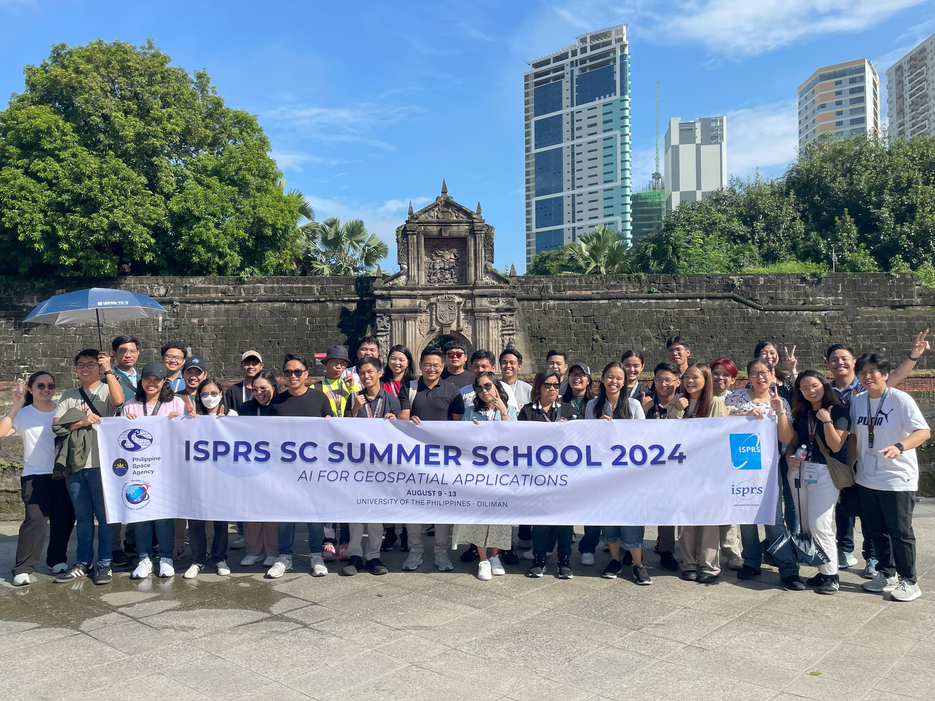
(Photo courtesy of: UP Department of Geodetic Engineering)
After the Midterm Symposium, an ISPRS Summer School entitled, “AI for Geospatial Applications,” was then held at UP Diliman, Quezon City from 9 to 13 August 2024.
Hosted by the UP Department of Geodetic Engineering (UP DGE), and co-organized with the ISPRS Student Consortium, PhilSA, and the Philippine Geosciences and Remote Sensing Society (PhilGRSS), the classes covered cutting-edge GeoAI technologies, their applications across various industries, and hands-on experience through workshops and practical sessions.