


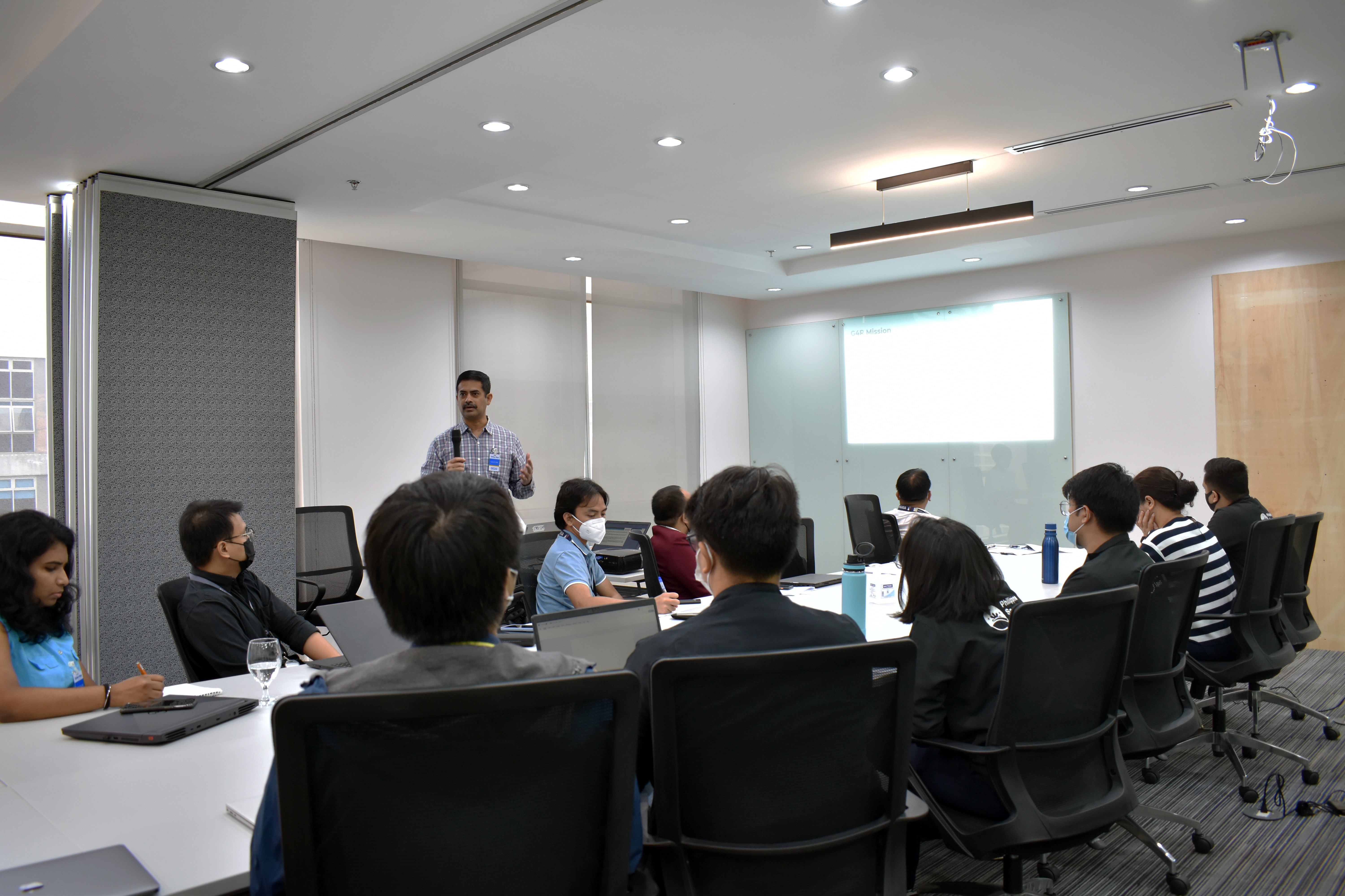
The Philippine Space Agency (PhilSA) and the International Water Management Institute (IWMI) organized a consultative workshop to promote and support multiscale, multilevel, and multisector policy development focused on groups that are most vulnerable to climate change such as small-scale farmers, women, the youth, and other disadvantaged sectors. Representatives from PhilSA, the Department of Interior and Local Government (DILG), Department of Environment and Natural Resources Mines and Geosciences Bureau (DENR-MGB), Philippine Atmospheric, Geophysical, and Astronomical Services Administration (PAGASA), National Mapping and Resource Information Authority (NAMRIA), UP Resilience Institute, and Philippine Red Cross participated in the workshop held at PhilSA Eastwood City office on 07 December. The CGIAR Climate Resilience Initiative, “Building Systemic Resilience against Climate Variability and Extremes,” or ClimBeR, facilitated the session. ClimBeR aims to address climate challenges by delivering science and innovation to improve food, land, and water systems, and increase the capacity for climate adaptation of six (6) identified climate hotspots: Guatemala, Kenya, Morocco, the Philippines, Senegal, and Zambia.
The workshop covered the development of climate information dashboards, AWARE (Early Warning Early Action Early Finance), and ClimaAdapt-Gov. AWARE is an open-source collaborative tool that aims to increase food and nutrition security among vulnerable households. Among the features of AWARE are key early-warning indicators from government agencies, and an accountability framework defining the roles and responsibilities of key actors in the humanitarian community to tighten the link between early warning and response.
Dr. Giriraj Amarnath, IWMI Principal Researcher and ClimBeR Lead for the Government for Resilience focus area underscored the importance of the tool, especially when allocating funds for response efforts. He cited instances where government authorities come up with arbitrary requests for billions in disaster response and management funding without sufficient basis: “Without having good data, without having good information, politically, people make a decision.” Such leads to a “failure in investment priorities,” Dr. Amarnath adds. Data indicators on climate, market, health, nutrition, and population displacement will be made available on the AWARE platform.
Dr. Giriraj Amarnath, IWMI Principal Researcher and ClimBeR Lead for the Government for Resilience during the consultative workshop.
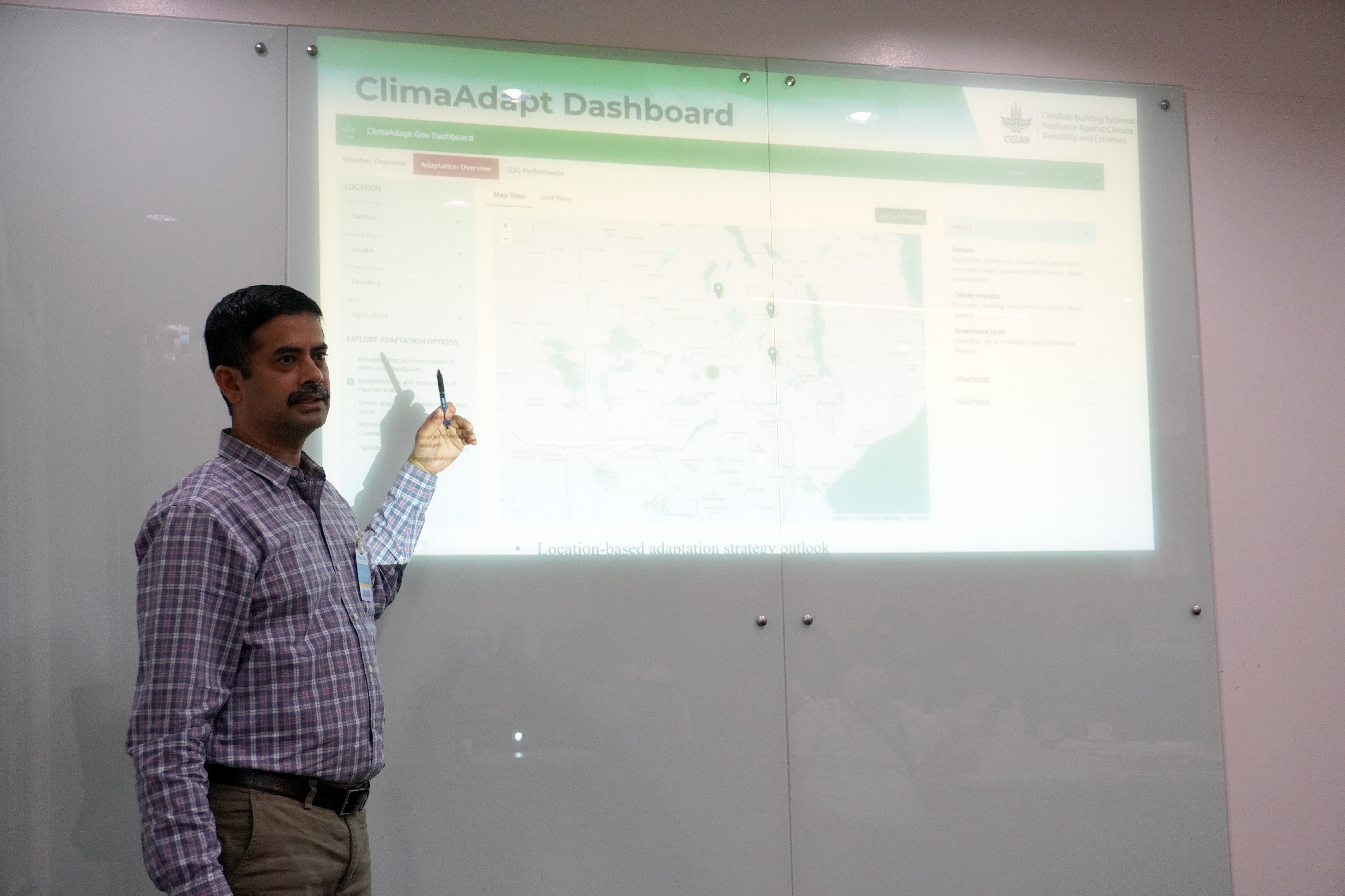
ClimBeR is also building the ClimaAdapt-Gov database, designed for high-level policy-making to empower farmers and communities through science-supported bottom-up planning and implementation of integrated climate water risk management interventions. One key feature of the dashboard is its tracking tool for funding allocation and utilization.
“Often, the case is, funds are allocated but it is not utilized. There are a lot of challenges in implementing the projects on the government side…Most of the time, the project is evaluated based on expenditure. Even if the cabinet has approved the budget, if the ministry of the national institution doesn’t spend, it means you didn’t do any activity,” Dr. Amarnath explains. Through ClimaAdapt-Gov, the progress of institutional projects in line with sustainable development goals (SDGs) can also be monitored. AWARE and ClimaAdapt-Gov are envisioned to be in regular use in ClimBeR countries by 2023. By 2024, through climate science and sustained engagement with relevant sectors in the climate hotspots, ClimBeR hopes to encourage new climate adaptation investments by the national, regional, and global agencies amounting to 5 to 7 million USD.
PhilSA is set to participate in ClimBeR. Prior to this, PhilSA has been actively assisting the government and the private sector in using information from space for climate resilience. This is in line with its mandate under RA 11363, or the Phillippine Space Act, to improve public access and resource sharing of space assets and information to enable government agencies and private institutions to deliver better services. Data from space provide actionable information for disaster responders, policy-makers, and vulnerable communities to better adapt, prepare, and come up with more effective and innovative efforts to mitigate the impacts of climate change.
PhilSA is also developing the Multispectral Unit for Land Assessment or MULA satellite – the biggest Earth observation satellite being built by the Philippines to date, capable of capturing 5m resolution images covering around 73-thousand square kilometers in 24 hours. Data from MULA are envisioned to contribute to the country’s food security, disaster resilience, environment conservation, and national security.