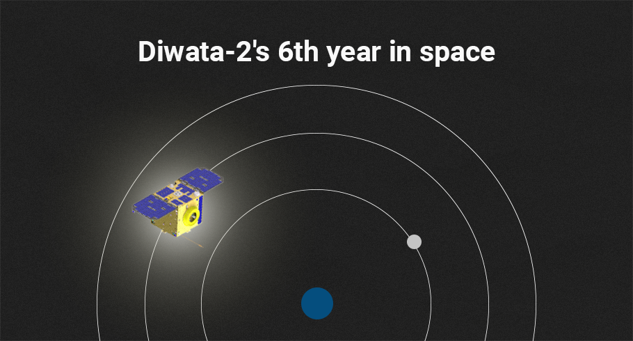
Diwata-2, the Philippines’ second Earth observation satellite, is now on its 6th year of operations, exceeding its 5-year expected lifespan.
It continues to capture satellite imagery of the Philippines which is used for environmental assessment, agricultural management, and post-disaster monitoring. Through the Sentinel Asia network, Diwata-2 provides satellite imagery of affected areas during calamities to neighboring countries for disaster response.
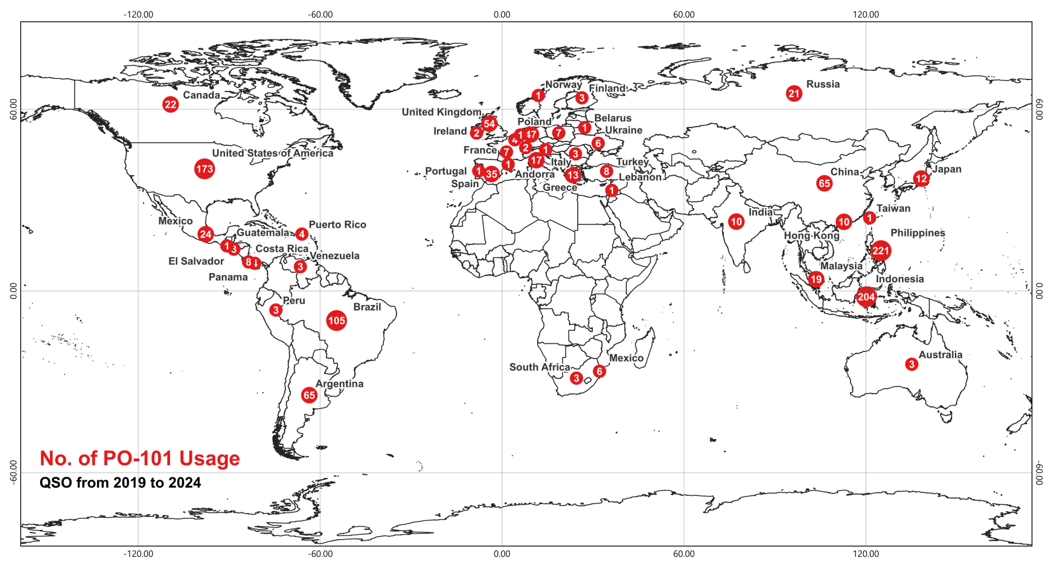
While in space, Diwata-2 remains actively operational, continuing its mission with its amateur radio unit (ARU), which has provided valuable service to radio enthusiasts across the world. The map below displays the distribution of ARU usage across countries from 2019 to 2024, highlighting the number of communications made by each country using PO-101. This provides insights into geographic trends in usage, supporting analysis of ARU engagement over the years.
Check out the images captured by Diwata-2’s High Precision Telescope (HPT):
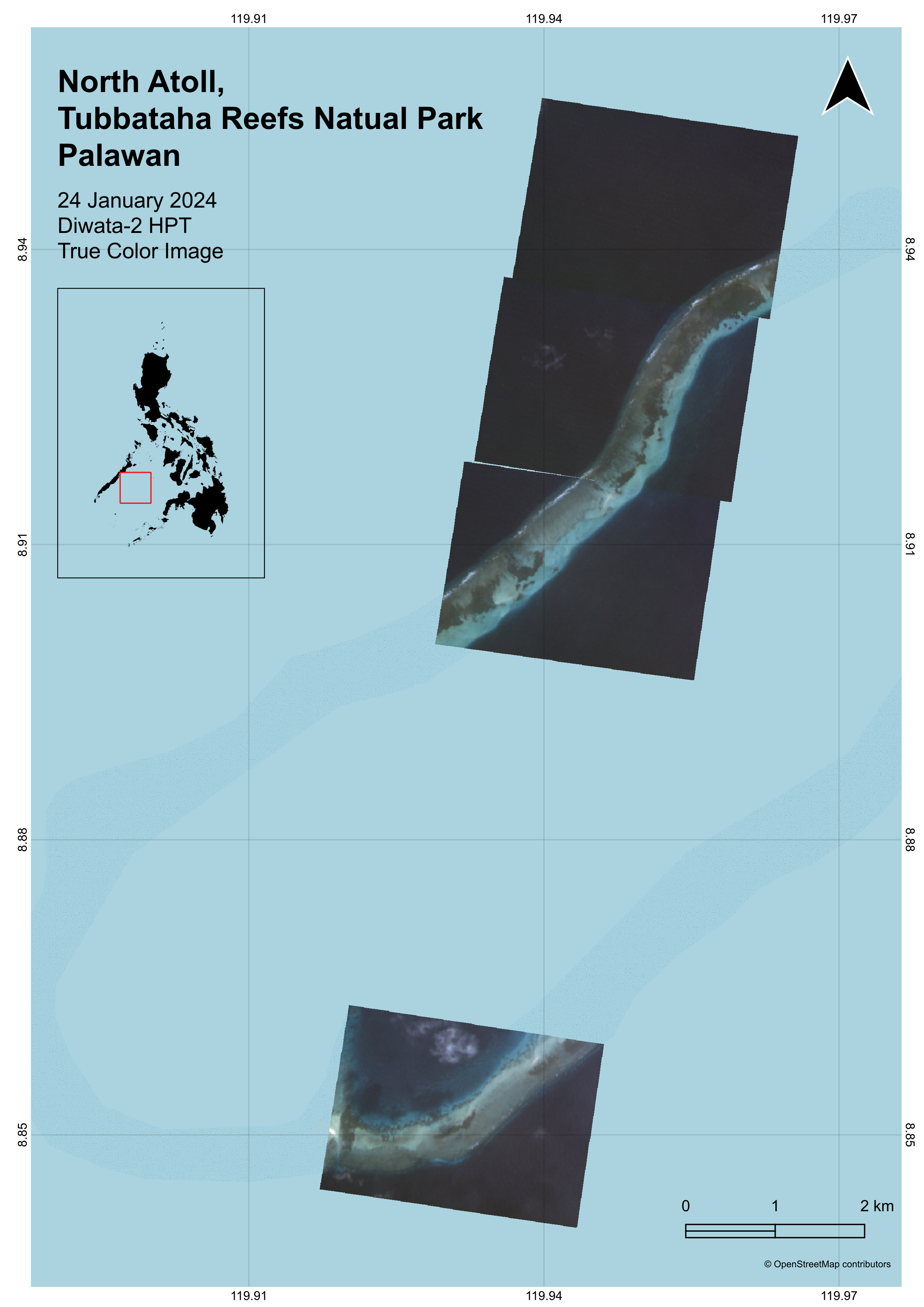
Tubbataha Reef, Palawan
Diwata-2 captures the North Atoll of Tubbataha Reef Natural Park last 24 January 2024. The North Atoll spans 4-5 kilometers in width and forms a complete enclosure around a sandy lagoon. In the image, portions of the reef are shown shallow and exposed which occurs during low tide. The natural park is located in the middle of Sulu Sea; and is a home to great diversity of marine life.
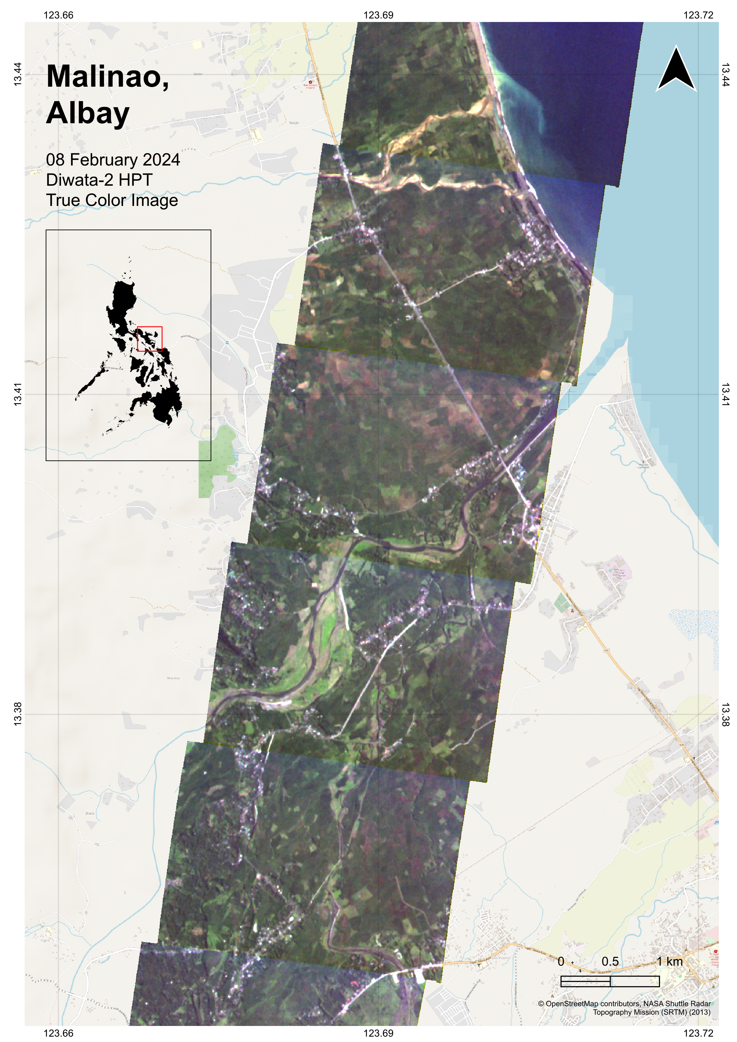
Malinao, Albay
Diwata-2 captures Municipality of Malinao, Albay on 08 February 2024. The province of Albay prides itself on its natural resources and formations–the most famous of which is located just south of the Municipality of Malinao. The image shows clear municipality’s agricultural land along Comun River.
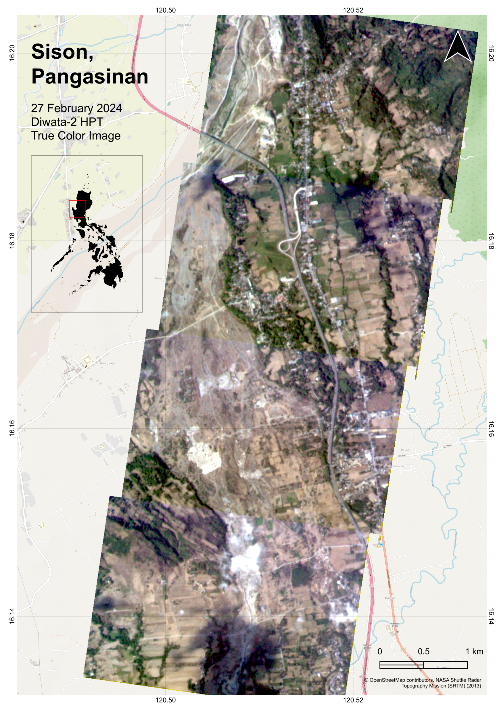
Sison, Pangasinan
On 27 February 2024, Diwata-2 passed over Sison, Pangasinan Province. This image highlights the Bued River alongside an interchange on the Tarlac–Pangasinan–La Union Expressway.
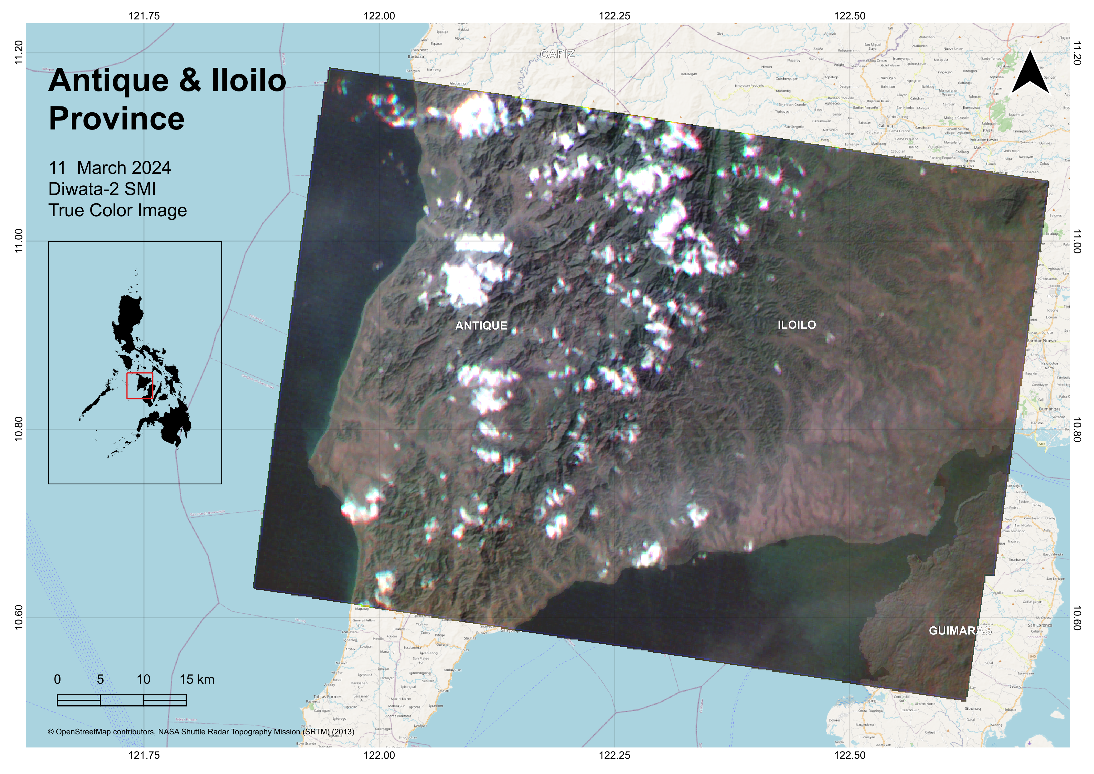
Antique & Iloilo Province
Diwata-2 captures Panay Island showing portion of Antique and Iloilo Province on 11 March 2024. The scene shows Sibalom Natural Park, several mountains, Mount Batulinao, Mount Palaypay, Mount Tambara, Mount Tuyas, Mount Mantalas.
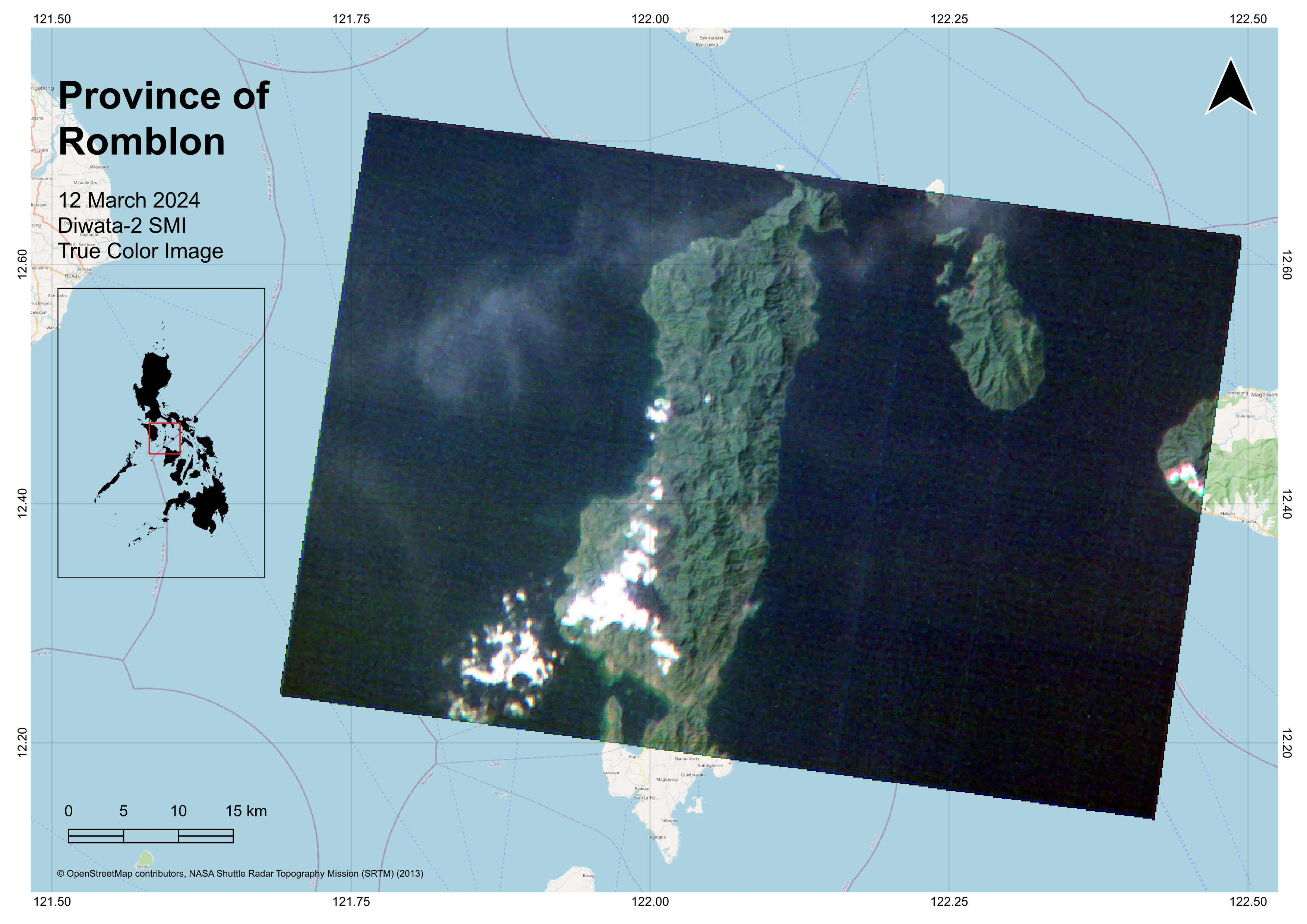
Province of Romblon
Diwata-2 captures Romblon Island, Tablas Island and portion of Sibuyan Island last 12 March 2024. Romblon is known for its local marble industry and is the second biggest producer of minerals in the country.
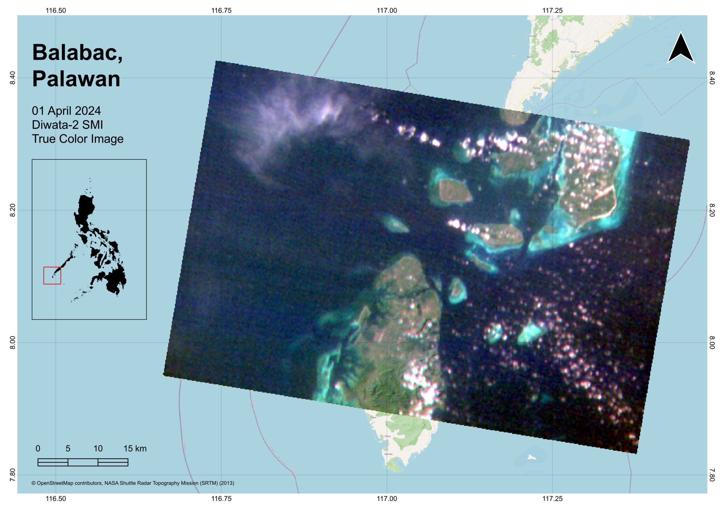
Balabac, Palawan
Diwata-2 image shows a group of islands i.e. Ramos Island, Mantagule Island, Bancalan Island, Bugsuk Island and Dalahican Island, Onuk Island among others, of the Balabac municipality in Palawan on 01 April 2024. The municipality is known for beaches, unspoiled islands, and turquoise waters.
Did you know that Diwata-2 is used by scientists to determine typhoon intensity? By using Diwata-2 imagery from multiple angles, scientists can reconstruct detailed 3D models of typhoons which they then use to calculate the strength of typhoon winds. This process is called stereo photogrammetry.
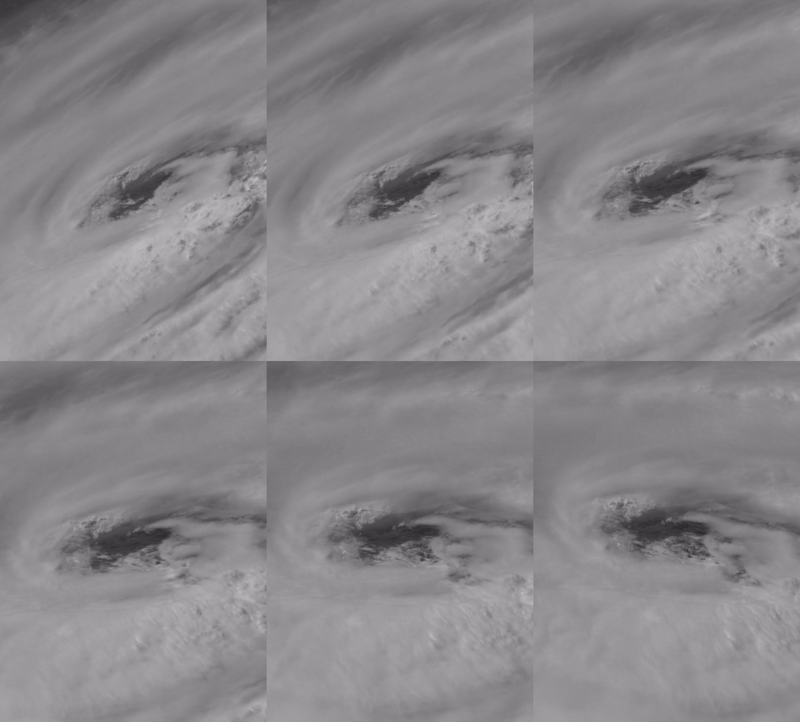
Typhoon Mindulle captured on 30 September 2021
Building on the achievements of Diwata-2, the development of the Multispectral Unit for Land Assessment (MULA) marks an exciting new phase in the Philippines’ satellite capabilities. The Multispectral Unit for Land Assessment (MULA) is the Philippines’ first and largest commercial-grade satellite, currently under development. MULA is designed to support the nation’s goals in food security, disaster resilience, environmental conservation, and national security. Alongside Diwata-2, the Philippines also has partial ownership of the NovaSAR satellite, an S-band radar satellite actively operated by PhilSA.
For access to data from Diwata-2, NovaSAR, and other satellite data sources, contact smcod@philsa.gov.ph or accomplish the Call for Satellite Image Acquisition and Data Utilization through this link: https://bit.ly/4ho3CaX


